The air quality maps, which cover the whole of mainland France, show information on the levels of ozone, nitrogen dioxide (NO2) and suspended particulate matter (PM 10 and PM 2.5) in the air that we breathe.
Run by the Prev'Air system operated by the Ministry of the Environment, the maps show air quality levels on that day, as well as offering a forecast for the following day.
READ ALSO
- Is France doing enough to tackle air pollution?
- What are the 10 places with the worst air pollution in France?
- Older model diesel cars banned in Paris
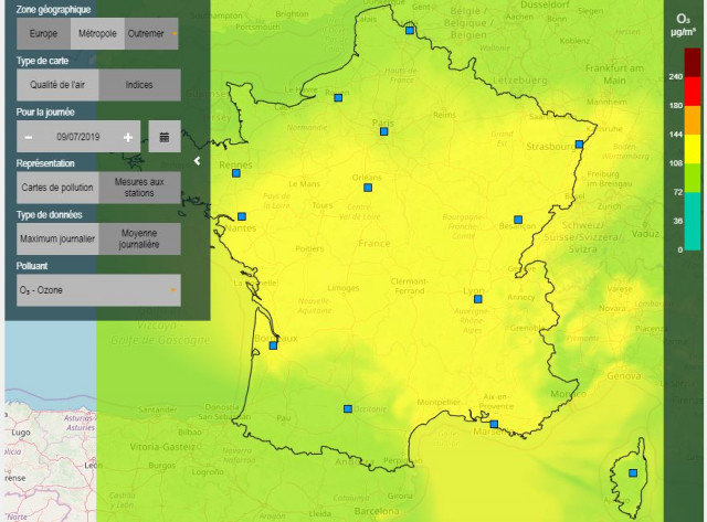
Map: Prev'Air
There are thirteen air quality control bodies in France and the map links to the different areas, which offer colour-coded ratings of the air quality from good to medium and poor.
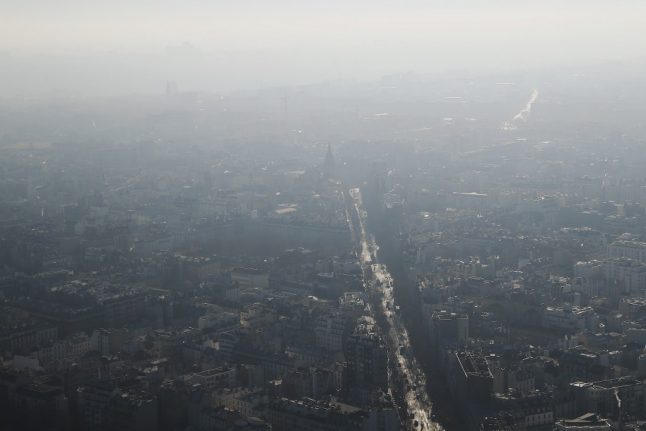
Air quality has been a particular problem for Paris, with the city regularly breaching targets for safe levels of air pollution.
On Tuesday, Paris declared a 'climate emergency' following in the footsteps of cities including New York, Brussels and London.
“Paris, like other cities, declares a climate emergency,” Celia Blauel, deputy mayor in charge of the environment, told a municipal council meeting, stressing the need to adhere to the objectives of the 2015 Paris Climate Accord.
The declaration also said Paris city hall would create a “climate academy” with the aim of better educating the young and the public about the issue.
Last month the French state lost a court case brought by a mother and daughter who said the high level of air pollution around the Paris ringroad caused them both health problems.
To access the map, click here.
Member comments