SHARE
COPY LINK

WEATHER

Trains in northern Germany cancelled over storm

Several train services in the northern half of the country are being cancelled due to severe weather warnings.

A sign on a train in Dortmund says 'do not board'. Lots of services have been cancelled due to the storm.
A sign on a train in Dortmund says 'do not board'. Lots of services have been cancelled due to the storm. Photo: picture alliance/dpa | Bernd Thissen

After storm Ylenia hit the country on Wednesday night and Thursday, a new weather front called Zeynep is expected on Friday afternoon, bringing with it extreme winds and lots of rain.

And it’s having an impact on travel. 

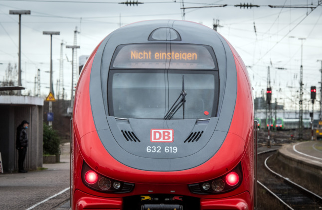
Deutsche Bahn said on Friday that several regional and long-distance services in the northern half of the country were being suspended.

The suspension of regional services affects Schleswig-Holstein, Hamburg, Lower Saxony and Bremen, as well as parts of North Rhine-Westphalia.

The cancellations will take place gradually “during the course of the day”, the spokesperson said. In North Rhine-Westphalia, this was to begin on some lines from 2pm.

READ ALSO: Germany issues extreme weather warning for next storm

In the long-distance network, connections from Hamburg in the direction of Berlin, Hanover and Cologne are affected. ICE and IC services on the east-west route between Cologne via Hanover to Berlin were also suspended on Friday. 

Deutsche Bahn said there would be “no more long-distance trains north of Dortmund, Hanover and Berlin”.

Meanwhile, ICE and IC trains between Frankfurt(Main) or Berlin and Amsterdam have been cancelled throughout the day.

Free cancellation of tickets

The Deutsche Bahn spokesperson told Germany’s Tagesschau that the cancellations are due to “severe” storm warnings.

The rail operator is strongly advising that passengers postpone their journeys and rebook. Passengers can use their tickets booked for the period from Thursday to Sunday flexibly until February 27th, or cancel them free of charge if they postpone journeys because of the storm.

If that isn’t possible, passengers have been strongly advised to stay informed about the current storm and possibility of delays and cancellations.

Gusts of up to 160 km/h are predicted in some parts of northern Germany. 

Forecasters at the German Weather Service (DWD) predict storm Zeynep will affect the northern half and centre of Germany from Friday afternoon until early Saturday morning.

Member comments

Log in here to leave a comment.
Become a Member to leave a comment.

FLOODS

German communities brace for flooding as water levels continue to rise

Water levels on the Elbe and Oder rivers in Germany are rising, sparking preparations for floods as the clean-up across central Europe gets underway.

German communities brace for flooding as water levels continue to rise

As several countries in Europe face the devastating aftermath of severe flooding following torrential rain, communities in some regions of Germany are trying to manage rising water levels. 

According to a forecast by the state flood centre, the water on the Elbe river has not yet reached expected peaks. In the city of Dresden, the Elbe rose above the six-metre mark on Wednesday. There, as well as in Schöna on the border with the Czech Republic, the flood peak is expected on Thursday.

There is a cautious all-clear along other rivers in the east and south of Germany. Further north, however, Brandenburg is looking anxiously at the Oder river, which is expected to bring more water in the coming days.

READ ALSO: Parts of Germany hit by flooding as torrential rain wreaks havoc across central Europe

Flood crisis teams are due to meet in Frankfurt (Oder), located at the border with Poland, and other municipalities in Brandenburg on Thursday. A level 1 flood alert was issued for sections of the river on Wednesday.

According to the State Office for the Environment, floodplains and meadows close to the banks are expected to start flooding, with the areas of the Oder village of Ratzdorf to Eisenhüttenstadt particularly affected.

The state office believes the highest alert level – level 4 – with a water level of around six metres will be reached in the next few days near Ratzdorf, where the Oder reaches Brandenburg territory.

Clean-up work underway in central and eastern Europe

In the flood-hit areas from Poland to the Czech Republic and Austria, the clean-up work has now begun, but the situation is only slowly easing.

In many places, the emergency services are still struggling with masses of water. Soldiers are also providing support in Poland and the Czech Republic. However, the authorities are not yet giving the all-clear. So far, more than 20 people have tragically lost their lives in the region due to the extreme weather.

In the Polish city of Wroclaw in the west of the country, the flood wave was not expected until Thursday night. As several tributaries that also carry a lot of water flow into the Oder between Olawa and Wroclaw, the possibility of flooding in the Lower Silesian metropolis cannot be ruled out, said an expert.

Flooding in Bresgau Poland

A drone captures the high water levels in Bresgau, Poland, on September 19th. Photo: picture alliance/dpa/PAP | Maciej Kulczynski

Flood defences in Wroclaw have been reinforced as a precautionary measure. One third of the city of 630,000 inhabitants was flooded during the Oder flood in 1997.

EU Commission President Ursula von der Leyen is expected to visit Poland on Thursday afternoon. According to the EU Commission, the trip is being organised at the invitation of Polish Prime Minister Donald Tusk.

Czech Prime Minister Petr Fiala, his Slovakian counterpart Robert Fico and Austrian Chancellor Karl Nehammer are also expected to attend the meeting.

The talks are likely to focus on the question of funds from Brussels for reconstruction although the extent of the damage is still unclear.

With reporting from DPA

SHOW COMMENTS