SHARE
COPY LINK

WEATHER

IN PICTURES: ‘Exceptional’ Sahara dust cloud hits Europe

An "exceptional" dust cloud from the Sahara is choking parts of Europe, the continent's climate monitor said on Monday, causing poor air quality and coating windows and cars in grime.

IN PICTURES: 'Exceptional' Sahara dust cloud hits Europe
This photograph taken on March 30, 2024, shows thick sand dust blown in from the Sahara giving the sky a yellowish appearance above the French riviera city of Nice, southern France. - This color is due to the sand blown from the Sahara desert and north Africa which has been coming up since March 27, 2024. (Photo by Valery HACHE / AFP)

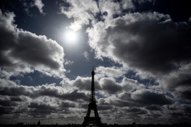
Copernicus Atmosphere Monitoring Service said the latest plume, the third of its kind in recent weeks, was bringing hazy conditions to southern Europe and would sweep northward as far as Scandinavia.

Mark Parrington, senior scientist at Copernicus, said the latest event was related to a weather pattern that has brought warmer weather to parts of Europe in recent days.

“While it is not unusual for Saharan dust plumes to reach Europe, there has been an increase in the intensity and frequency of such episodes in recent years, which could be potentially attributed to changes in atmospheric circulation patterns,” he said.

This latest episode has caused air quality to deteriorate in several countries, Copernicus said.

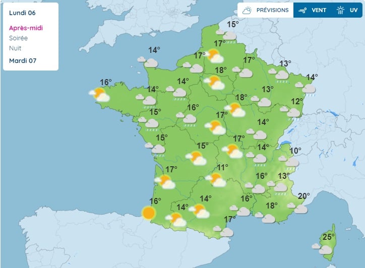
The European Union’s safe threshold for concentrations of PM10 — coarser particles like sand and dust that that can irritate the nose and throat — has already been exceeded in some locations.

A picture taken on April 8, 2024 shows a rapeseed field under thick sand dust blown in from the Sahara, giving the sky a yellowish appearance near Daillens, western Switzerland. – An “exceptional” dust cloud from the Sahara is choking parts of Europe, the continent’s climate monitor said, causing poor air quality and coating windows and cars in grime. (Photo by Fabrice COFFRINI / AFP)

The worst affected was the Iberian Peninsula in Spain but lesser air pollution spikes were also recorded in parts of Switzerland, France and Germany.

READ ALSO:

Local authorities in southeastern and southern France announced that the air pollution threshold was breached on Saturday.

They advised residents to avoid intense physical activity, particularly those with heart or respiratory problems.

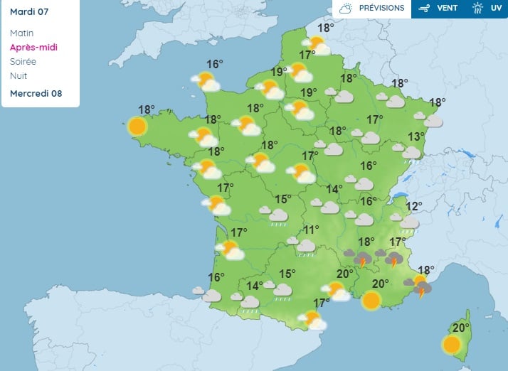
The dust outbreak was expected to reach Sweden, Finland and northwest Russia before ending on Tuesday with a shift in weather patterns, Copernicus said.

The Sahara emits between 60 and 200 million tonnes of fine dust every year, which can travel thousands of kilometres (miles), carried by winds and certain meteorological conditions.

The Spanish Canary Islands off the coast of northwest Africa saw just 12 days within a 90-day period from December to February where skies were free of Saharan dust, the local weather agency Aemet had reported.

Member comments

Log in here to leave a comment.
Become a Member to leave a comment.

WEATHER

Will we see the sun in France over May’s Ascension holiday week?

As people in France prepare to enjoy the two consecutive bank holidays, warmer temperatures are finally in sight. Here is what to expect in terms of weather for the 'pont de l'Ascension' week in France.

Will we see the sun in France over May's Ascension holiday week?

Forecasters in France expect warmer, sunnier weather for the days ahead, after several weeks of clouds and cold temperatures.

Unfortunately, in order to enjoy the sun you’ll have to wait through a few more days of rain. Here is what to expect for the rest of the week and the long weekend;

Monday

Rain is the dominating weather characteristic of the day, especially over Occitanie, PACA, Auvergne-Rhรดne-Alpes, Burgundy-Franche-Comtรฉ and the Grand-Est. Over in the west, skies will be mostly cloudy, and residents in Brittany and Normandy can expect storms later in the day, which could spread into parts of Centre-Val de Loire.

Where itโ€™s not raining, it will be mostly cloudy, with temperatures expected to rise to between 14C to 18C across most of the country, but could reach 21C on the Mediterranean coast and 26C in western Corsica.

Tuesday

More rain. With the exception of the far west of the country, which will get a preview of conditions to come as Tuesday goes on, rain is the weather order of the day, with storms predicted in southern areas from mid-afternoon and into the evening.ย 

Maximum temperatures are expected to range from 14C to 19C in the north of France, and from 11C to 20C in the southern half.

Wednesday May 8th – Public holiday for Victory in Europe day

The long public holiday weekend arrives, along with the sun. Other than in the far north early on, expect sunshine and mostly blue skies โ€“ though occasionally stormy showers may develop in the southeast later on.ย 

Temperatures of between 17C and 20C are forecast in the northern half of the country, and between 18C and 21C further south.

The map below from Mรฉtรฉo France gives a better idea of the weather across France on Wednesday afternoon.

Weather forecast for France on Wednesday May 8th. Mรฉtรฉo France

Thursday – Public holiday for Ascension

Mild. Dry. Sunny. Your three-word forecast for Thursday. There may be a few clouds in northern France, but the south is wall-to-wall sunshine for most of the day. Isolated storms may develop in the southern Alps late in the day.

Temperatures of between 18C and 20C are forecast in the northern half of the country, and between 19C and 24C further south.

Friday – Pont de l’Ascension – Day off for many with schools closed in France

Overcast conditions return in the northern half of the country on Friday, to remind everyone that itโ€™s not quite summer yet, but the skies remain clear in the south, with temperatures expected to climb past 25C in the southwest of the country.

Weekend

Other than a few thunderstorms in the south of the country, expect dry, warm, sunny weather across the whole of France over the weekend, with early summer temperatures reaching into the upper 20s celsius to match.

SHOW COMMENTS