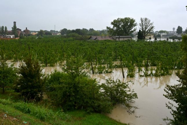
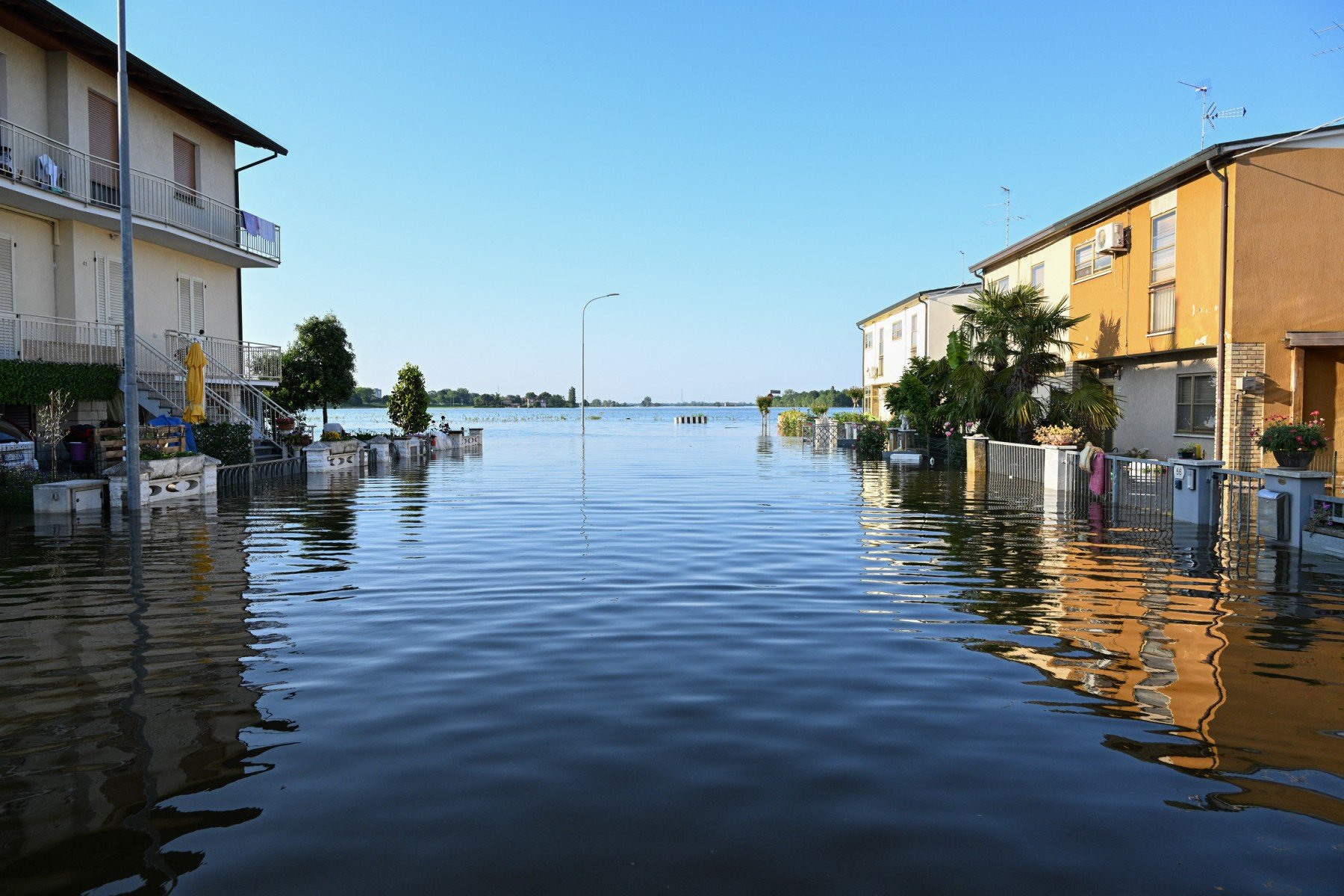
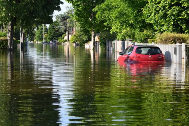
In mid-September 2024 large parts of Italy’s northeastern Emilia Romagna region were once again hit by floods which forced the evacuation of over 1,000 residents, as well as the temporary suspension of school classes and rail services in the worst-affected areas.
But this incident was only the latest in a long series of devastating flash floods that have hit Italy in recent years.
The Emilia Romagna region was struck by two deadly flooding events in the space of two weeks in May 2023.
Around six months later, in early November 2023, eight people were killed and hundreds evacuated after torrential rain caused rivers in the central Tuscany region to burst their banks, leading to severe flooding.
Why are floods so frequent in Italy?
According to the latest available data from environmental organisation Legambiente, Italy saw some 510 flooding events from January 2010 to September 2022, 88 of which happened in 2021.
Experts say Italy’s vulnerability to flooding events lies partly in its morphological features as there is often relatively little space available for flood waters to spread out across the territory due to it being limited by mountain ranges (or hills) on one side and the sea on the other.
This means that flood waters are likely to accumulate in relatively small areas, with water levels continuing to rise as a consequence.
READ ALSO: What you should do when there’s a flood warning in Italy
But the country’s natural susceptibility to flooding events is often exacerbated by human activities, including high levels of urbanisation and land consumption, which reduces the ground’s ‘permeability’ – that is to say its capacity to absorb excess water.
Finally, extreme weather events, including prolonged bouts of torrential rain, have become more frequent and intense in Italy in recent years due to climate change. Italy recorded 378 such events in 2023, up by 22 percent against 2022.
Which parts of Italy are most at risk of flooding?
According to Italy’s Institute for Environmental Protection and Research (Ispra), 14 percent (around 42,000 square kilometres) of the country is at low risk of flooding, 10 percent is at medium risk, and 5.4 percent is at high risk.
The remaining areas are labelled ‘no risk’, meaning that flooding events are highly unlikely.
But national figures don’t allow for an overview of where at-risk areas are located around the peninsula, which is why it’s worth analysing regional data.
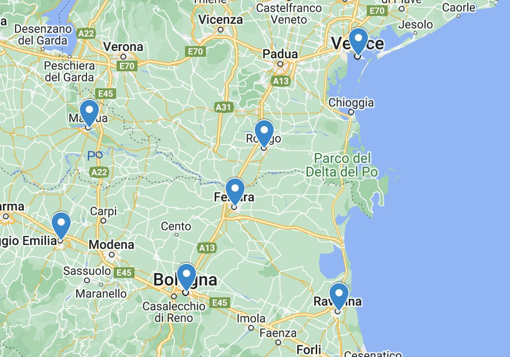
According to Ispra, Emilia Romagna, in the northeast of the country (see map below), is the Italian region with the highest percentage of at-risk land, with 47.3 percent (this includes high-, medium- and low-risk areas).
Ispra experts say this is partly due to the presence of small watercourses that run along “narrow riverbeds” and through “morphologically depressed areas” (or lowlands).
Emilia Romagna is followed by Veneto (32.2 percent), Friuli Venezia Giulia (21.5), Tuscany (21.2) and Lombardy (20,3).
When it comes to high-risk areas alone however, the southern Calabria region ranks first as 17.1 percent of its territory is considered to be at alto rischio.
Calabria is followed by Emilia Romagna (11.6 percent), Veneto (10), Friuli Venezia Giulia (9.6) and Lombardy (7.9).
Finally, when looking at provincial data, Ferrara (Emilia Romagna) and Rovigo (Veneto) are Italy’s most flood-prone provinces as at-risk areas (including high-, medium- and low-risk areas) cover 99.9 and 99.1 percent of their territories respectively.
Ferrara and Rovigo are two of a total of seven provinces in Italy where the percentage of at-risk land exceeds 50 percent of the provincial territory.
The others are Ravenna, Venezia, Mantua, Reggio Emilia and Bologna.
Member comments